
Adventures
- Art, History & Culture
- ATV & Motorsports
- Birding & Wildlife
- Clamming
- Crabbing
- Cycling
- Entertainment and Nightlife
- Fishing
- Fishing by Style
- Forest Bathing & Mindfulness
- Gaming
- Golfing
- Hiking & Walking
- Lighthouses
- Ocean Life & Tidepooling
- Our Complete Guide to Forest Bathing
- Running
- Scenic Drives
- Shopping
- State Parks and National Lands
- Storm Watching
- Theatres
- Undeveloped Beaches
- Untamed Dunes
- Water Recreation
Cycling
Make Some Tracks!
Whether you take to the road, fat bike on the beach, or careen around single-track trails, you will find heart pumping options on Oregon’s Adventure Coast. Our friends at the Front Street Community Bike Works have put together a wonderful resource of cycling trail maps from no hills to dare devil! Click here for the City Bike Riding Trails Map (PDF). Rent e-bike cruisers from Bahama Boards in Coos Bay! Call (541) 808-3535 for more information!
The Oregon Coast Bike Route
Check out The Oregon Coast Bike Route (PDF). Oregon has been supporting bicycling since 1971 by developing bikeways throughout the state. Thousands of bicyclists enjoy the natural beauty of the Oregon Coast Bike Route annually. For the most part, it follows US Highway 101 as a shoulder bikeway. In several areas, the route departs from the main highway and follows county roads and city streets. These sections are closer to the ocean, are more scenic, and have lower traffic volumes and slower traffic speeds. Coos Bay, North Bend, Charleston is one of the areas where cyclists depart from the main highway and takes a scenic detour along the rugged coastline on Cape Arago Loop and 7 Devils Road. Click here for the North Bend to Bandon Oregon Coast Trail Map.
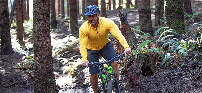
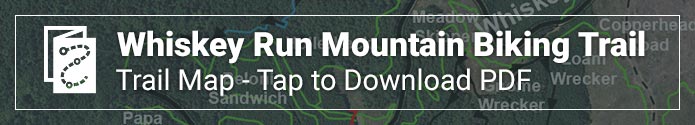
Whiskey Run Mountain Biking Trail
Check out the MTB Project’s online Whiskey Run Mountain Biking Trail map here. The Whiskey Run Mountain Bike Trails is a one-of-a-kind trail system on the Southern Oregon Coast, located between Coos Bay and Bandon. Ribbons of clay dirt flow and wind through the Coos County Forest in these cross-country style trails. Moderate climbing and fun descending make this system worth the drive to the gorgeous Southern Oregon Coast. The 30-mile trail system is located about 15 minutes south of Coos Bay off Highway 101, in the mists of the coastal forest.
Located in an active logging forest, Whiskey Run gives visitors a view of the Coos County Forest most do not get to see - seeing harvesting in this coastal forest while they are enjoying sweeping views, tranquil streams, and fern-covered forest floors. The trails are a blend of flow and cross country style, and are great for all levels of riders with open sightlines, easy climbs, and chances to catch some air if you want. You’ll dip and wind through the forest in this unique South Coast environment.
These professionally built trails are made to withstand the coast’s weather, so when the weather is unfavorable in the Cascades and you want to ride some loam and clay, come on down to the coast. However, please don’t ride if the trails are muddy. Check trail reports or call the local shops or guide services.
Click here for even more information on Whiskey Run Trails.
BLUE RIDGE LOOP - is a multi-use trail system that gets some motorcycle traffic. It is a scenic area to ride, though despite it’s elevation, views of lower areas are limited to non-existent. Given the different roads throughout the area, there are multiple ride options.
WINCHESTER NORTH - are used primarily by mountain bikers and motorcycles. The trails challenge even the best of riders. There are lots of ruts, roots, steep terrain, and other obstacles on the 17 miles of winding single track.
EMPIRE LAKES - provides a more leisurely trail for biking but it is no less scenic. The trail system, 4 miles paved and 1.5 miles dirt track, is in John Topits Park, centered on the natural beauty of two lakes and stabilized dunes within the park.
EUPHORIA RIDGE TRAILS - this 10 mile track begins on dirt road and quickly moves to single-track trails, through meadows, forest land, and tribal lands. Euphoria Ridge Middle Trail and Euphoria Ridge Upper Trail
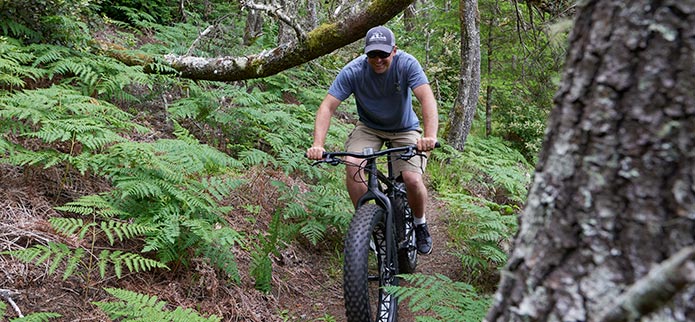
Fat Tire Biking
From rocky headlands to wide-open shores, agates, seabirds, tide pools and lighthouses in the distance, the Oregon Coast is a balm for the soul. Why ride it? Because its 363 miles of glorious coastline are full of wonder, largely car-free and accessible for us all. - Jen Anderson, Travel Oregon
Grab your big, balloon tires and bring your bike down to the beaches and the dunes. Ride along the miles of Horsfall Beach and into The Dunes for a challenging experience. As Katy Bryce put it in her article, Fat Biking 100 Miles of Oregon Coast , “Riding fat bikes is not just beach cruising! The Oregon Dunes National Recreation Area provided us with the opportunity to shred hard in soft sand. Hike up. Slide down. Giggle. Repeat.”
Wherever you go fat tire biking on Oregon’s Adventure Coast, check the tides and try to go during low tide as much as possible. Beware of sneaker waves and stay off rocks and small, enclosed beaches. Respect the sensitive micro-environments, whether it’s birds or anemones you encounter.
RENTALS: Blue Sky Bike Shop is NOW OFFERING fat tire bike rentals: Surly Bikes Wednesday (Med/Lg) and Ice Cream Truck (XL)! Give the shop a call (541-808-2646) or email to reserve your rental today!

Gravel Cycling
Gravel cycling is becoming a top attraction all over the country and right here in the Coos Bay Area. According to www.adventurecycling.org , when you think of gravel riding, you may think of being in a remote place surrounded by trees or mountains. However, gravel riding simply means riding on any manner of unpaved surfaces; even if it’s a completely flat, well-traveled dirt road. The joy of riding on unpaved surfaces is that they’re usually car-free or in low traffic and naturally scenic areas.
In Coos Bay, Dirty Free Hub has documented a fantastic Gravel Cycling Route through the Elliott State Forest to Golden & Silver Falls State Natural Area and the surrounding area. With an elevation gain of more than 3800 feet and a loop of 34 miles, this is a challenging ride, but the scenery cannot be beat.

Pedal the Rails! (Seasonal Activity)
For something completely different, take to the rails with the Joy Rails Coquille . Pedal along the beautiful Coquille River towards Coos Bay on a four seater quardricycle on the scenic Coos Bay Historic Railway for six miles. The trip begins in the community of Coquille just 17 miles inland from Coos Bay. Rail trips are available May through September.
You will pedal round trip for about twelve miles on unused track. Staff will turn your four seated railrider around as you take a break.
Help Save the Rails! Pedal the rails to save the rails and preserve railroad history. Railriding is a stupendous way to experience the out- of -doors and experience first-hand rail corridors seen only by railroad workers or perhaps an excursion train or two.