
Five Hiking Destinations to Explore on Oregon's South Coast

Summer is here and we think it’s time for you to take a hike! Coos Bay, North Bend and Charleston, Oregon residents and visitors have access to some of the most stunning and diverse landscapes in the country; whether it’s climbing majestic sand dunes or biking through a rugged coastal forest or walking along paths overlooking the Pacific, and now is the time to grab your hiking boots and head this way for a beautiful adventure.
Here are five hiking destinations to explore this summer (or any time of the year) on Oregon’s Adventure Coast:
Please note, hiking conditions are subject to weather patterns and other elements outside our control. Please check the websites posted with each listing below before heading out.
#1 OREGON DUNES NATIONAL RECREATION AREA
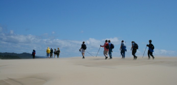 When one of the largest areas of temperate coastal sand dunes in the world is located in your back yard, you hike it! Miles and miles of towering wind-sculpted sand dunes make the famed Oregon Dunes National Recreation Area a perfect location for hiking and photo opportunities. Though there are numerous trails to choose from, here are a few that captured our imagination:
Bluebill Lake Trail Trail Length: 1.2 mile Level of Difficulty: Easy Trail Features:
- Great for hiking, walking and bird watching
- Great lake views and extensive boardwalk for wildlife viewing
- Dogs allowed on leash
- Open Year Round
- More info & maps can be found at alltrails.com/trail/us/oregon/bluebill-lake-trail
John Dellenback Trail Trail Length: 5.4 miles round-trip (There’s also a shorter, family-friendly route of just 1 mile) Level of Difficulty: Moderate- Challenging Trail Features
- A variety of terrain and sweeping views of the dunes, beach, and coastal forest
- Stunning vegetation and wildflowers
- Accessible year-round
- Dogs allowed on a leash
- More info & maps can be found at alltrails.com/trail/us/oregon/john-dellenback-trail
#2 SHORE ACRES LOOP HIKE- Sunset Bay to Simpson Beach
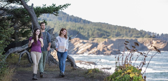 This section of the Oregon Coast Trail , open year-round, is regarded by many as one of the most beautiful hikes in the state of Oregon. Dense, coastal forests, rugged sandstone cliffs, and majestic vista points provide make this a very popular destination for nature lovers and hikers of all levels. Be sure to bring a camera with you for the all but certain wildlife photo opportunities you’ll encounter. Trail Length: 4.7 miles Difficulty: Easy Trail Features:
- Premium tide pool exploration opportunities at Sunset Bay State Park & Simpson Beach
- Shore Acres State Park, the crown jewel of Oregon’s South Coast
- Great views of Gregory Point and Cape Arago Lighthouse
- Dramatic vistas of the Pacific
- Coastal forests
- Access to restrooms, picnic, and camping facilities
- More info & maps can be found at oregonhikers.org/field_guide/Shore_Acres_Loop_Hike
#3 CAPE ARAGO LOOP
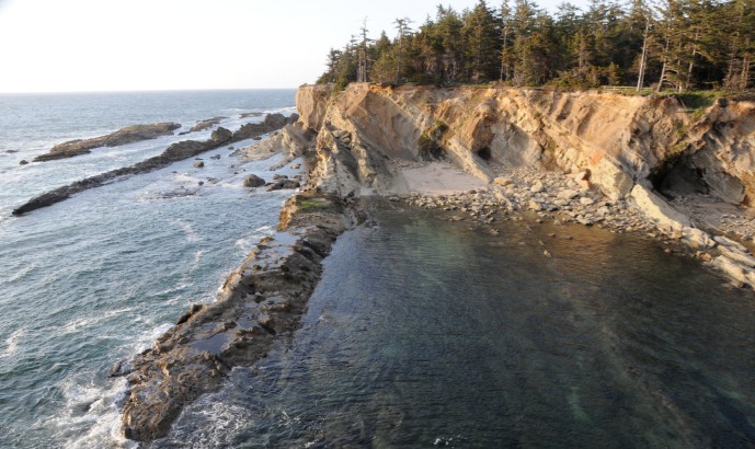
This scenic, oceanfront trail is typically less traveled than other trails mentioned in this post. Located 15 minutes from Coos Bay, this hiking destination is the perfect place to lose yourself in nature. “This hike features the quieter side of the spectacular Sunset Bay, Shore Acres and Cape Arago complex of state parks south of Coos Bay,” writes Zach Urness in this 2016 Statesman Journal article . “Before starting the loop hike, take the time to explore two short treks just off the parking area. The North and South Cove trails lead to tidepools, beaches and viewpoints where you can say hello to barking sea lion.” Please note the North Cove Trail is closed March 1st – June 30th to protect seal pups.
Trail Length: The entire loop is 4.3 miles Level of Difficulty: Moderate- challenging Trail Features:
- A moderately challenging trek through dense coastal forests
- A rare World War II bunker hidden among the brush
- Natural scenery and sweeping views of the Pacific.
- Views of seals and sea lions on Simpson Reef and Shell Island
- More info & maps can be found at www.oregonhikers.org/field_guide/Cape_Arago_Loop_Hike
#4 SOUTH SLOUGH NATIONAL ESTUARINE RESEARCH RESERVE
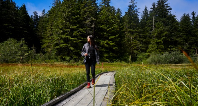 The trails at South Slough National Estuarine Research Reserve (SSNERR) are one of Oregon’s best-kept secrets. In addition to its unbeatable natural surroundings, SSNERR hikers have access to some of the best birding spots that Oregon has to offer, so be sure to bring binoculars with you! Hikers say these trails are well maintained and relatively easy to hike, however, there are uphill portions to conquer so be prepared! We recommend downloading a free trail map if you’re planning to make the trek!
Trail Length: Ranges from 2.2 miles to 3.5 miles Level of Difficulty: Easy- Moderate Trail Features:
- Hiking trails for all ability levels
- Boardwalk that winds through fresh and saltwater marshes
- Lush coastal Vegetation and wildlife
- Interpretive center with restrooms
- Accessible year-round. Dogs are also able to use this trail but must be kept on leash.
- More info & maps can be found at alltrails.com/trail/us/oregon/south-slough
#5 GOLDEN AND SILVER FALLS
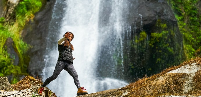 Located almost an hour’s drive from Coos Bay at the end of Coos River Highway, Golden and Silver Falls is 24 miles off Highway 101. A hidden gem in the dense coastal forests of southwest Oregon, Golden and Silver Falls State Natural Area may be hard to find, but it’s well worth drive and the drive is certainly part of the adventure. A small parking and picnic area is located along the banks of Glenn and Silver Creeks, set in an old-growth forest of Douglas fir, Big Leaf Maple and Oregon myrtle trees. Hiking trails wind through scenic canyons to each of the waterfalls that plunge over sheer rock cliffs to moss-covered boulders 100 feet below.
Trail Length: 1.4 miles Level of Difficulty: Easy Trail Features:
- Two of Oregon’s most beautiful waterfalls
- Lush coastal forests, giant old-growth firs and cedars
- Picnic tables, restrooms
- Tons of photo opps
- More info & maps can be found at alltrails.com/trail/us/oregon/golden-and-silver-falls